

For military planners, the most dangerous gap is often not a lack of information but the time required to turn information into understanding. A satellite may capture an image of a border crossing, a convoy route or an emerging logistics site, yet the value of that image can diminish while it waits in a queue of ground stations, processing centres and headquarters.
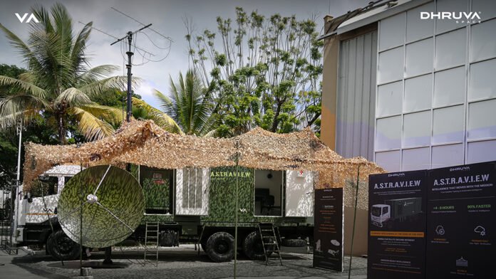
Dhruva Space’s A.S.T.R.A.V.I.E.W is designed to close that gap and it was put on display at the recently concluded BSX 2026 in Bangalore. Dhruva Space CEO & Co-founder Sanjay Nekkanti told Raksha Anirveda that the company is the Event Sponsor of BSX in Bengaluru, recognising the expo as a marquee platform for India’s rapidly evolving Space-Tech ecosystem. At BSX 2026, the Hyderabad-based Space Tech startup showcased their achievements and capabilities as a Space Tech infrastructure provider, given the significant growth of the Indian space ecosystem over the last few years.

The mobile platform is designed to eliminate delays between satellite tasking, data reception, analysis and operational decision-making
Sanjay further explained that A.S.T.R.A.V.I.E.W is a mobile Space-based intelligence and command vehicle designed to bring satellite-enabled intelligence closer to the operational theatre. The vehicle integrates AstraView, Dhruva Space’s satellite data-access and intelligence platform, which provides access to data from constellations of more than 200 satellites, including SAR and RF data through partners such as Vantor and Planet.
This enables users to directly access, task and exploit satellite-derived data while integrating satellite reception, secure communications and edge processing within a mobile platform. By bringing these capabilities closer to the tactical edge, A.S.T.R.A.V.I.E.W can reduce dependence on fixed ground infrastructure and support faster situational awareness and mission planning. The vehicle-agnostic architecture can be configured for customer-designated military platforms and deployed across contested, austere and multi-domain environments.
Built around an Ashok Leyland all-terrain vehicle, the system brings a satellite ground segment directly to forward-deployed units
Taking Space Intelligence to the Tactical Edge
The acronym A.S.T.R.A.V.I.E.W (full form: Agile Space-Enabled Tactical Reconnaissance & Awareness Vehicle for Intelligence Exploitation & Wide-Area Surveillance) describes a mobile intelligence platform that receives and processes satellite data close to the point of need. Instead of depending entirely on fixed ground infrastructure, the system places the essential elements of a satellite ground segment inside a compact, all-weather, all-terrain vehicle.
The result is a shift from centralised processing to forward-edge exploitation. According to the system overview, a conventional pipeline can take between 48 and 96 hours to move from satellite tasking to finished intelligence. A.S.T.R.A.V.I.E.W aims to reduce that cycle to approximately four to eight hours.

That compression could change how commanders use commercial and sovereign satellite assets. A forward team can task a satellite, receive the downlinked data, process it and begin analyst assessment without waiting for the information to travel through several separate facilities. Finished intelligence can then be shared with operational headquarters while the situation remains current.
The architecture supports optical, Synthetic Aperture Radar and hyperspectral data, extending surveillance across weather, terrain and light conditions
Col Rajneesh Ralli (Retd.), Vice President – Growth Operations, Dhruva Space, told Raksha Anirveda that modern conflicts increasingly blur the line between tactical and strategic operations, as tactical events can have strategic consequences, but A.S.T.R.A.V.I.E.W aims to give field commanders access to strategic-level Space intelligence at the point of decision. Ultimately, the system is designed to enable operational leaders to make faster, data-driven decisions at the point of action, across tactical operations and crisis-response scenarios.

The vehicle platform demonstrated for the system is based on an Ashok Leyland vehicle configuration. The platform is compact and most importantly mobile, while the product architecture is intended to remain vehicle-agnostic and configurable. That flexibility would allow the system to be adapted to different operational requirements and deployment environments.
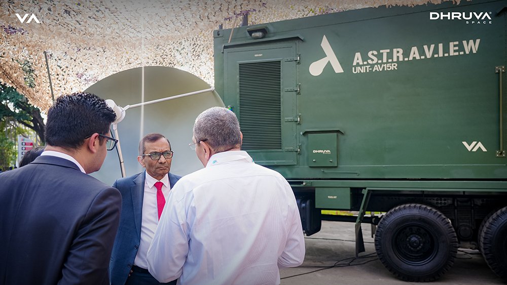
The tracking architecture is anchored by a combination of antennas: Dhruva Space’s VHF / UHF antenna systems and Safran Data Systems’ ARES-240 and ARES-550 mobile satellite tracking systems. These provide precision tracking and antenna pointing for LEO spacecraft, including commercial and sovereign missions. These antenna variants use a dual-band concentric feed and are designed to track Low Earth Orbit satellites. Their mobile configuration allows the antenna system to be deployed away from permanent ground stations and repositioned as operational conditions change.
The platform also incorporates Safran’s SATCORE Combo Box, combining command-and-control modem functions with high-rate reception. Maestro Monitoring & Control software supports satellite acquisition, tracking and data-reception activities. Together, these elements establish an integrated TT&C and high-rate data reception chain, enabling automated spacecraft acquisition, tracking and downlink operations with minimal operator intervention.
Its combination of Safran tracking equipment, SATCORE hardware and Maestro software enables autonomous satellite acquisition and high-rate data reception
The system is described as entirely Indian-designed and equipped, with an option involving Safran under a strategic partnership. It is intended for rapid deployment across the varied terrain faced by the Indian Armed Forces. Further the system could also support disaster management and relief operations by providing timely data at affected locations, Col Ralli further added.
From Multiple Sensors to a Virtual Constellation
A.S.T.R.A.V.I.E.W’s surveillance value also depends on the diversity of the data it can handle. Optical imagery can provide detailed visual information under clear conditions. SAR can support observation through clouds and during darkness, while hyperspectral data can reveal material and environmental differences not always visible in conventional imagery. Used together, these sources can support border monitoring, maritime awareness, disaster response and infrastructure surveillance.
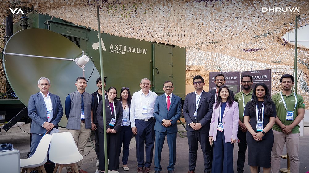
That multi-sensor approach aligns with Dhruva Space’s proprietary AstraView commercial satellite imagery service. Launched in 2024, AstraView was built through partnerships with providers including Capella Space, Planet, Vantor, Geosat, Wyvern, Axelspace and others. The service offers access to electro-optical, SAR, radio-frequency and hyperspectral data, allowing users to search archives or request new collections.
Dhruva Space’s wider AstraView ecosystem connects users to imagery from more than 200 satellites and multiple commercial data providers
Dhruva Space’s AstraView is a virtual constellation and unified Space-based intelligence access layer, aggregating imagery from 250+ satellites across multiple sensors and data providers. It addresses the fragmentation of today’s Earth Observation ecosystem (where users must navigate multiple providers, platforms and data interfaces) to enable single-window archive discovery, fresh tasking and multi-sensor mission planning, helping users move from disparate satellite data sources to actionable intelligence faster.
Closing the Last-Mile Intelligence Gap
For A.S.T.R.A.V.I.E.W, that wider ecosystem could provide the data supply while the vehicle supplies the tactical access point. One system helps determine what should be collected; the other helps ensure that the resulting data reaches analysts close to the operation.
The concept reflects a broader change in military intelligence. Space-based surveillance is no longer confined to large, permanent facilities or exclusively government-owned satellites. Commercial constellations now offer frequent coverage and multiple sensing modes, but their operational advantage depends on how quickly users can task, receive and interpret the information.
Already seeing significant interest, A.S.T.R.A.V.I.E.W is built around that final-mile challenge. By moving reception and exploitation closer to deployed forces, Dhruva Space is attempting to turn satellite imagery from a delayed strategic product into a more immediate tactical resource – one capable of informing decisions while events are still unfolding.

-The writer is a New Delhi-based senior commentator on international and strategic affairs, environmental issues, an interfaith practitioner, and a media consultant. The views expressed are personal and do not necessarily carry the views of Raksha Anirveda