

Every monsoon, Assam counts its losses in the same currency: lives, homes and hectares under water. This year the Brahmaputra overran its banks again, killing at least 50 people and displacing around seven lakh. Further west, flash floods out of Tibet devastated parts of Nepal while the Kosi stayed dangerously high. The grief is local, but the questions behind it are transboundary. How much water is coming? When will it arrive? And what is being built upstream that could change the answer?
For the families strung along the Siang and the Brahmaputra, those questions are measured in hours. A flood wave takes about 12 hours to travel from Pasighat to Dibrugarh. That is enough time to move people, livestock and grain to higher ground, but only if someone has seen the water coming. Today, India has no formal window across the border to see it.

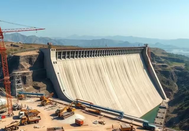
That last question now has a name: Medog. At the Great Bend of the Yarlung Tsangpo, where the river drops nearly 2,000 metres before entering Arunachal Pradesh as the Siang, China is building the world’s largest hydropower project, a planned 60,000 MW, nearly three times the size of Three Gorges. The project, estimated at $167.8 billion, is expected to generate close to 300 billion kilowatt-hours a year once commissioned by 2033. It is not one wall of concrete but five dams strung across a 250-km gorge, sited roughly 30 kilometres from the Indian border. Approved in December 2024, the project began construction in July 2025, and it is moving faster than any Indian response to it.
At the Great Bend of the Yarlung Tsangpo, where the river drops nearly 2,000 metres before entering Arunachal Pradesh, China is building the world’s largest hydropower project. The site sits in a highly seismically active zone
The risks are not Indian paranoia. The site sits in one of the most seismically active zones on earth, a hazard flagged in The Medog Imperative, a 2026 report by Stockholm’s Institute for Security and Development Policy. More strikingly, Chinese state-backed scientists have themselves warned of serious dangers. A 2026 study by geologists from Chengdu University of Technology and the China Geological Survey identified the Paizhen Fault as a “highly active fracture” running through the construction site, and recommended slope reinforcement and retaining structures against landslides. Small wonder that Arunachal Chief Minister Pema Khandu calls it a “water bomb” for the Northeast.
India’s Answer: A Dam of its Own
New Delhi’s main answer has been to build. The 11,200 MW Siang Upper Multipurpose Project (SUMP), planned by NHPC and the Arunachal government, has been pitched as a defence against China’s water moves: a giant reservoir, with about 9.2 billion cubic metres of live storage, that could absorb a sudden release from upstream. The logic is understandable. But the idea is not new. SUMP was declared a national project in 2008, and nearly two decades later it is still at the pre-feasibility stage, with no dam site finalised.
A 2026 study identified the Paizhen Fault as a ‘highly active fracture’ running through the construction site and recommended slope reinforcement and retaining structures to prevent landslides. Arunachal Chief Minister Pema Khandu calls it a ‘water bomb’ for the Northeast
A Project Losing its People
The politics, meanwhile, are collapsing. After more than a year of peaceful opposition, protests turned violent on September 30, when an MLA’s house in Yingkiong was vandalised. On October 23, organisations called a 12-hour bandh across Siang, Upper Siang and East Siang. That night, a mob set an NHPC office and a police station ablaze in Pasighat. The Siang Indigenous Farmers’ Forum estimates that 40 villages along the river would be affected, and activists and local media have faced a crackdown. A ₹350 crore livelihood programme for 26 villages had barely started when the protests resumed. Worse, the Indian dam would stand in the same high-seismic belt as the Chinese one.

Information, Not Storage
Here lies the flaw in the counter-dam strategy. A mega-dam is a 15-year answer to a problem that kills people every monsoon. What India lacks right now is not storage; it is information. On that front, the cupboard is bare. The 2002 MoU under which China shares Brahmaputra flood-season data, renewed in 2008, 2013 and 2018, expired in June 2023 and is still under renegotiation. The Sutlej MoU lapsed in 2020. Both fell victim to the post-Galwan freeze. The government has told Parliament that China has not shared hydrological data on the river since June 2023.
In October 2018, a landslide blocked the Yarlung Tsangpo in Tibet and, within a day, built up a lake holding hundreds of millions of cubic metres of water. At that time, Chinese authorities informed India
Even when the arrangement worked, it was thin. China shared rainfall, water level and discharge twice a day from three stations, Nugesha, Yangcun and Nuxia, between May 15 and October 15, and India paid a fee for the privilege. In 2017, the year of the Doklam standoff, Beijing declined to share data at all, citing station upgrades. All three stations lie north of the Himalayan crestline, upstream of the gorge where the Medog is rising. That leaves roughly 320 km of river between Nuxia and Tuting, the first Indian station, with no flow data at all, which is precisely the stretch where the Parlung Tsangpo joins and where landslides and flash floods are most likely. Even a renewed MoU on old terms would say nothing about what the new dams release. The Expert Level Mechanism set up in 2006 was meant to fill such gaps, but it meets when relations allow and has no power to compel an answer.

The moment to fix this has rarely been better. Xi Jinping landed in New Delhi on September 12, 2026, for the BRICS summit, his first visit in nearly seven years. Two weeks earlier, the Special Representatives agreed an eight-point consensus that pushes for an “early and substantial harvest” on the boundary. Tellingly, the same text promised an Expert Level Mechanism meeting on trans-border rivers in September, with renewal of the data MoUs on the agenda. When ties were first restored after Kazan, the two sides had already agreed to an early meeting on resuming river data, and in August the Ministry of External Affairs was still pressing for one. Commitments on rivers keep being made and remade; what is missing is delivery. If New Delhi can negotiate an early harvest on a contested frontier, it can negotiate one on rivers, where the case for cooperation is far easier to make.
None of this means India should abandon storage on the Siang. Flood cushioning has value, and a future reservoir may well be part of the answer. But sequencing matters
Three Asks for New Delhi
India should table three asks. First, renew the Brahmaputra and Sutlej MoUs as multi-year, year-round agreements with near-real-time data, so that a flood warning does not depend on the season or the state of relations. Second, extend coverage downstream: gauging stations below the Great Bend, at sites such as Gompo Ne and Mêdog, and advance notice of reservoir filling, flushing and emergency releases from the new dams. Third, upgrade the mechanism itself, starting with a fixed annual calendar and a standing agenda item on data failures, and moving over time to a joint river commission with a legal mandate. China already provides flood-season data to Bangladesh; India strengthens its hand by leading a cooperative framework across the Ganges–Brahmaputra–Meghna basin rather than negotiating alone.
Data alone does not save lives; it has to reach the last village. Any new agreement should be matched at home by investment in the forecasting chain: more gauges on the Siang and its tributaries, warnings pushed to phones in Assamese, Adi and Mising, and evacuation drills held before the monsoon rather than during it. A warning that arrives in Delhi but not in Dhemaji is no warning at all.
Getting the Threat Right
Some honesty about the threat also helps. The Medog site sits on a stream that accounts for only 20–25 percent of the water flowing into India; much of the Brahmaputra’s volume is generated by monsoon rain on the Indian side. The fear that China will “turn off the tap” is overstated. But that cuts both ways. The real dangers are not drought by design. They are a sudden release, a landslide-dammed lake, a seismic failure, or simply an opaque operating schedule during a heavy monsoon. Every one of those risks is reduced by data and warning, not by a second reservoir.
The project still needs a Social Impact Assessment, an Environmental Impact Assessment and a Detailed Project Report before construction can even be considered. That is time India can use well
This is not theoretical. In October 2018, a landslide blocked the Yarlung Tsangpo in Tibet and, within a day, built up a lake holding hundreds of millions of cubic metres of water. At that time, Chinese authorities informed India. The East Siang administration warned residents to stay away from the river, low-lying villages were put on alert, and NDRF teams were deployed. In June 2000, when a flood from Tibet surged down the Siang, China had not informed India. The gap between those two episodes is the whole argument of this piece: a call across the border is worth more than a reservoir that does not yet exist.
Diplomacy Before Concrete
None of this means India should abandon storage on the Siang. Flood cushioning matters, and a future reservoir may be part of the answer. But sequencing matters. A dam pushed through amid bandhs, violence and blocked news feeds will lose the consent of the very communities it claims to protect, and a strategic asset built on local resentment is a weak one. Consultation with the Adi villages, credible seismic studies and transparency about displacement should come first. The project still needs a Social Impact Assessment, an Environmental Impact Assessment and a Detailed Project Report before construction can even be considered. That is time India can use well.
Diplomacy, in other words, should run ahead of concrete. The thaw has given India summits, flights and a joint text on the boundary. The next deliverable should be one that a farmer in Dhemaji or a family in Pasighat can feel: a warning that arrives before the water does. India needs to know what is coming down the Brahmaputra before it decides how much to build in its path.

The writer is an independent researcher. The views expressed are of the writer and do not necessarily reflect the views of Raksha Anirveda