


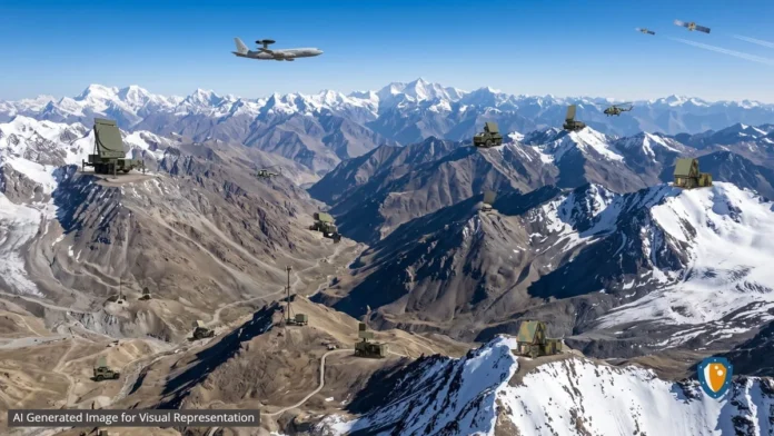
New Delhi: India is quietly constructing a sophisticated surveillance shield across the Himalayas to counter China. This effort stretches from Ladakh to Arunachal Pradesh and represents a fundamental shift in India’s defence strategy.
Instead of relying solely on visible assets such as fighter aircraft and missile systems, New Delhi is building an integrated, multi-layered surveillance architecture designed to provide persistent situational awareness in one of the world’s most difficult military environments.

The transformation accelerated after the 2020 Galwan Valley clash, which reshaped India’s security outlook along the Line of Actual Control. China has since expanded military infrastructure across Tibet and Xinjiang, including new airbases, hardened shelters, drone facilities and integrated air-defence networks. These developments compelled India to rethink traditional surveillance models and move towards persistent sensor dominance, aiming to detect aircraft, UAVs, cruise missiles and missile launches as early as possible.
India’s surveillance network is layered to overcome terrain and weather challenges. At the highest level, satellites form the backbone. CARTOSAT satellites monitor infrastructure and deployments, RISAT provides Synthetic Aperture Radar imaging through cloud and snow, EOS ensures persistent observation, and EMISAT strengthens electronic intelligence by tracking radar emissions.
Future military satellite programmes are expected to enhance ELINT, SIGINT and long-range tracking, feeding directly into the Integrated Air Command and Control System (IACCS) for near-real-time awareness.
Airborne platforms add another layer. India is expanding its fleet of AEW&C aircraft, including Netra Mk1 and Phalcon AWACS, with the upcoming Netra Mk2 programme expected to deliver larger radar apertures, longer endurance and improved tracking of stealth targets. Flying above mountain ranges, these aircraft overcome terrain limitations that ground-based radars face.

On the ground, India is deploying Mountain Radars in Gulmarg and Nagaland, strengthening surveillance over Ladakh, Kashmir, Arunachal Pradesh and the eastern Himalayas. These are likely the first phase of a broader plan to establish a continuous radar chain across Himachal Pradesh, Uttarakhand, Sikkim and Arunachal Pradesh.
Complementing them are Arudhra Medium Power Radars integrated with IACCS, Ashwini AESA radars designed for mobility and rapid deployment, and specialised systems like Bharani and Low-Level Lightweight Radar Mk-II to detect helicopters, drones and low-flying aircraft exploiting valleys.

Passive surveillance technologies add resilience. Electronic intelligence stations and passive sensors monitor radar emissions and communications without transmitting signals, making them harder to detect. These systems are crucial against stealth aircraft such as China’s J-20 and emerging J-35. India’s approach focuses on identifying stealth presence through VHF radars, multi-band networks and sensor fusion before handing targets to other systems.
At the centre of this architecture lies IACCS, the digital nervous system of India’s air defence. It integrates satellites, radars, AWACS, electronic sensors and fighter aircraft into a unified operational picture, enabling commanders to monitor threats and coordinate rapid response.
The next stage will involve artificial intelligence to process vast data streams, automatically correlating inputs, predicting flight paths, prioritising threats and recommending defensive actions.
This surveillance ecosystem reflects India’s transition towards network-centric warfare. Facing China’s expanding Tibetan airbases at Hotan, Ngari Gunsa, Shigatse and Lhasa Gonggar, supported by drones and stealth aircraft, India is building one of the most advanced high-altitude surveillance networks in the region.
By combining satellites, airborne systems, ground radars, passive sensors and IACCS, India aims to achieve information superiority, continuous surveillance and faster decision-making, creating an invisible yet formidable shield across the Himalayas.