Modern warfare is no longer confined to conventional tactics and strategies. The advent of disruptive technologies such as systems-of-systems integration, drone technology powered by GeoIntelligence (GeoInt), and artificial intelligence (AI) has revolutionised the battlefield. These advancements have redefined conflict dynamics, often tipping the scales of victory in favour of the technologically superior force. This transformation is evident in ongoing global conflicts, where drones and GeoInt play pivotal roles in intelligence gathering, precision targeting, and operational planning.

This article explores the multifaceted role of GeoInt-based drone applications in modern warfare, with a particular focus on the Indian Army’s operational requirements in challenging terrains and forward areas. We also delve into the emerging technologies and trends shaping the future of drone warfare and the operational strategies needed to maintain strategic dominance.
GeoInt: The Strategic Backbone of Modern Warfare
GeoInt has become an indispensable tool in modern military operations, revolutionising how armed forces plan, execute, and respond to dynamic battlefield scenarios. By integrating geospatial data from satellites, drones, sensors, and on-ground intelligence, GeoInt delivers actionable insights that ensure operational superiority. Leveraging advanced analytics powered by AI and machine learning, it synthesises data from diverse sources such as high-resolution satellite imagery, drone feeds, LiDAR scans, thermal imaging, and GIS platforms to provide comprehensive, real-time intelligence. This capability enhances decision-making, reduces reaction times, and mitigates uncertainties in complex environments. Additionally, GeoInt’s predictive analytics integrates historical and real-time data, enabling military planners to forecast enemy actions, anticipate logistical challenges, and optimise resource allocation for mission success, making it a critical enabler of precision and efficiency in modern warfare.

Key Features of GeoInt in Modern Warfare
The Israel Defense Forces (IDF) and the Russia-Ukraine conflict provide compelling case studies of how GeoInt-enabled drones have revolutionised modern warfare. The IDF has been at the forefront of leveraging these technologies, utilising drones for Intelligence, Surveillance and Reconnaissance (ISR), electronic warfare, and psychological operations. A standout example is the GOSPEL AI target-creation platform, which has dramatically increased targeting capacity, significantly enhancing operational efficiency. Another innovative application includes the use of robots equipped with Ground Penetrating Radar (GPR) to detect underground tunnels, bolstering situational awareness and counter-infiltration measures. Similarly, the Russia-Ukraine war underscores the versatility of GeoInt-enabled drones in unconventional warfare. From deploying loitering munitions and kamikaze drones to conducting ISR missions with LiDAR and thermal imaging, these drones have been pivotal in artillery detection and precise countermeasures. Together, these examples highlight the transformative potential of GeoInt-driven drone technologies in addressing diverse and complex battlefield scenarios.

GeoInt in Military Operations
Core Applications of GeoInt in military operations are as under:
(a) Surveillance and Reconnaissance: GeoInt enables continuous, real-time monitoring of enemy movements, troop deployments, and terrain changes, providing unparalleled situational awareness. Integrating UAV sensors with advanced GeoInt analytics facilitates highly accurate day-night surveillance. Technologies like thermal and multispectral imaging detect hidden movements, while LiDAR scans offer a three-dimensional understanding of terrain features. These capabilities empower field commanders to stay ahead of adversaries by visualising potential threats and identifying vulnerabilities, ensuring informed and strategic decision-making in dynamic operational environments.
(b) Target Detection and Identification: GeoInt leverages advanced imagery intelligence (IMINT) to achieve high-precision identification of enemy assets, including artillery positions, command centres, and supply depots. By incorporating AI-based algorithms, GeoInt enhances target classification, effectively distinguishing military assets from civilian infrastructure to minimise collateral damage. A notable example is its application in counter-terrorism operations, where drones equipped with GeoInt systems have successfully isolated high-value targets, enabling surgical precision in strike missions and significantly improving operational outcomes.
(c) Battlefield Mapping: GeoInt provides highly detailed terrain mapping, offering critical insights into elevation, vegetation cover, and hydrological features essential for operational planning. These maps play a strategic role in facilitating troop movements, designing defensive fortifications, and identifying chokepoints or ambush-prone areas. Leveraging AI-powered platforms, GeoInt ensures dynamic updates by integrating satellite imagery and ground intelligence, maintaining accuracy and relevance even during fast-paced and evolving military operations.
(d) Environmental Monitoring: GeoInt systems integrate meteorological data to provide valuable weather and terrain insights, enabling accurate predictions of weather conditions and terrain feasibility for troop movements, drone operations, and vehicle mobility. This capability is especially critical in high-altitude warfare regions like Ladakh, where extreme weather poses significant challenges. GeoInt helps commanders mitigate risks by forecasting avalanches, landslides, and weather anomalies, ensuring operational continuity. Additionally, its environmental insights optimise supply chain routes and resource allocation, enhancing logistical efficiency in remote or inaccessible areas.
From the Indian defence perspective, GeoInt-enabled drones deployed along sensitive border regions act as critical force multipliers by providing real-time updates on the enemy’s troop movements. In high-tension scenarios along the IB/LAC/LoC, GeoInt systems monitor enemy build-ups, identify potential flashpoints, and proactively inform strategic decisions
Operational Impact: Enhancing Border Security with GeoInt-Enabled Drones
From an Indian defence perspective, GeoInt-enabled drones deployed along sensitive border regions, act as critical force multipliers. Equipped with advanced sensors, these drones provide real-time updates on adversarial troop movements, significantly enhancing the precision of tactical deployments. By leveraging AI-driven surveillance tools, they can detect infiltration attempts with unparalleled accuracy and relay vital intelligence to command centres, enabling coordinated multi-domain operational responses. In high-tension scenarios, such as heightened activity along the IB/LAC/LoC, GeoInt systems monitor enemy build-ups, identify potential flashpoints, and proactively inform strategic decisions. This capability ensures a robust defensive posture for the Indian Armed Forces while maintaining the operational flexibility required to address evolving threats and secure national borders effectively.
Drones as Tactical Force Multipliers in Modern Warfare
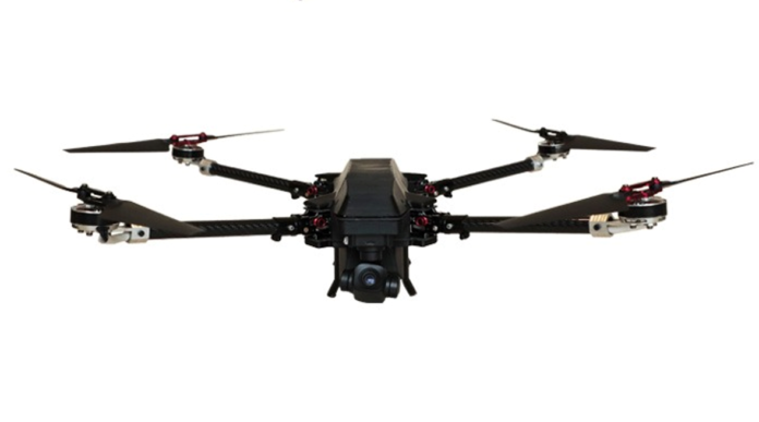
Drones integrated with GeoInt have emerged as pivotal tactical force multipliers, revolutionising combat and surveillance operations. Their adaptability, combined with cutting-edge technological sophistication, enables a wide range of applications tailored to specific operational needs. In India, military drones are classified based on weight, mission type, and capabilities, adhering to guidelines established by the Directorate General of Civil Aviation (DGCA). These classifications ensure that drones are optimised for their intended use, whether in ISR, Kamikaze/combat, or logistics.
Seamless Integration of Advanced Technologies in GeoInt-Enabled Drones
The effectiveness of GeoInt-enabled drones lies in their seamless integration with cutting-edge technologies, making them indispensable for modern military operations. These drones are designed to adapt to dynamic battlefield scenarios, ensuring precision, efficiency, and reliability in diverse environments. Key technological integrations include:
(a) AI-Driven Autonomy: Artificial intelligence empowers drones to process real-time data and operate autonomously in hostile environments. They can identify threats, adjust flight paths to avoid detection, and prioritise targets with minimal human intervention. For example, in high-risk areas like the Line of Actual Control (LAC), AI-driven drones enhance mission success by dynamically adapting to changing conditions while reducing operator workload. AI enhances mission planning by using historical and real-time data to forecast enemy actions and optimise resource allocation. For instance, drones capturing sequential images of an area can detect changes over time, aiding in infrastructure monitoring, encroachment detection, and battlefield planning. This predictive capability ensures better preparedness and efficient use of resources.

(b) Real-Time Data Fusion: GeoInt-enabled drones combine inputs from multiple sensors, including GPS, LiDAR, and Inertial Measurement Units (IMUs), to provide actionable insights. This real-time fusion of geospatial and on-ground intelligence allows for pinpoint accuracy in tracking targets and relaying critical information to command centres. Such capabilities are particularly effective in counter-terrorism operations, where precision and timeliness are paramount.
(c) 5G Connectivity: The integration of 5G networks ensures high-speed, low-latency communication between drones and ground control stations, even in remote and rugged terrains. This enables real-time transmission of high-resolution imagery and supports coordinated operations requiring rapid decision-making, making 5G a game-changer for modern drone applications.
Thermal and multispectral imaging detects hidden movements, while LiDAR scans offer a three-dimensional understanding of terrain features. These capabilities empower field commanders to stay ahead of adversaries by visualising potential threats and identifying vulnerabilities, ensuring informed and strategic decision-making in dynamic operational environments
(d) Swarming Technology: Swarming technology enables drones to operate cohesively as a group, offering unmatched capabilities for large-scale surveillance and mission execution. Leveraging mesh networks and onboard computing, swarms maintain resilience and adaptability. For example, a swarm can monitor multiple infiltration routes along the LoC simultaneously, identify unauthorised movements, and relay synchronised intelligence to field units, significantly enhancing situational awareness. Scalable for grassroots deployment, small teams can manage swarms effectively, making this technology versatile for various battlefield scenarios.
(e) Integrated Drone Systems: Combining tethered, untethered, and swarming drones into a system-of-systems architecture maximises operational efficiency. Data from these drones is transmitted through integrated management software to backend AI systems, where it is processed and visualised on interactive dashboards. This approach allows commanders to access real-time insights, including live video feeds and AI-driven analytics, enabling informed and coordinated decision-making across large operational areas.

Sensor Integration: Enhancing Precision and Versatility
The precision and adaptability of GeoInt-enabled drones largely depend on the integration of advanced sensors, which collect critical data for mission planning and execution. These sensors provide detailed insights through various resolution capabilities:
(a) Spatial Resolution: Spatial resolution determines the level of detail captured in imagery, crucial for precise targeting. For example, high-spatial-resolution sensors can identify camouflaged enemy positions in densely forested areas, ensuring accurate strikes with minimal collateral damage.
(b) Spectral Resolution: Spectral resolution enables the differentiation of wavelengths, making it invaluable for applications like mineral detection or monitoring crop health in disputed border areas. This capability can also detect explosives or hazardous materials during reconnaissance missions.
The integration of 5G networks ensures high-speed, low-latency communication between drones and ground control stations, even in remote and rugged terrains. This enables real-time transmission of high-resolution imagery and supports coordinated operations requiring rapid decision-making, making 5G a game-changer for modern drone applications
(c) Temporal Resolution: Temporal resolution tracks dynamic events by capturing imagery at regular intervals. For instance, during natural disasters such as floods or landslides in conflict-prone regions, drones with high temporal resolution can monitor changes in real time, aiding both disaster management and military logistics.
(d) Radiometric Resolution: Radiometric resolution detects subtle variations in intensity, such as temperature gradients or light sensitivity. High-radiometric-resolution sensors are particularly effective in intruder detection, enabling the identification of heat signatures even during night time operations.

Sensor-integrated and GeoInt-enabled drones have become indispensable across a wide range of critical domains and challenging environments. In security operations, drones with thermal imaging and radiometric sensors detect unauthorised movements or intruders in high-security zones, ensuring robust surveillance and quick countermeasures. GeoInt-enabled drones further extend their capabilities to border surveillance by monitoring unauthorised movements across vast stretches with real-time alerts. They also play a critical role in logistics and resupply operations, autonomously delivering supplies to remote and high-altitude posts, reducing logistical challenges. In counter-terrorism efforts, drones equipped with advanced imaging and communication sensors assist in identifying and neutralising threats in insurgency-prone regions. Additionally, in high-altitude operations, these drones perform reconnaissance in areas inaccessible to human mobility due to extreme weather conditions, ensuring effective situational awareness and operational success.
Future Trends in Drone Technology
Advancements in drone technology are driving transformative capabilities across multiple operational dimensions. Stealth technology is enabling drones to operate undetected in hostile environments, ensuring critical missions are carried out discreetly. Manned-Unmanned Teaming (MUMT) is unlocking new tactical possibilities by facilitating coordinated operations between drones and manned platforms, enhancing mission versatility. Cloud-based systems are revolutionising data processing and storage, providing advanced situational awareness and improved mission planning. Additionally, next-generation sensors are delivering enhanced precision and adaptability, allowing drones to excel in diverse and challenging operational scenarios, further solidifying their role as indispensable assets in modern warfare.
Conclusion
GeoInt-enabled drones have become indispensable in modern military operations. By integrating advanced sensors, AI, and robust communication systems, these drones provide real-time intelligence, precision targeting, and unmatched operational efficiency. GeoInt has positioned geospatial data as a cornerstone of military strategy, enabling adaptability, informed decision-making, and enhanced readiness to meet evolving challenges. As India continues to invest in these technologies, the Indian Armed Forces are well-equipped to ensure mission success, maintain national security, and address emerging threats with precision and resilience.
–The writer is an SME and independent consultant in military technology. The views expressed are of the writer and do not necessarily reflect the views of Raksha Anirveda


